
Introduction
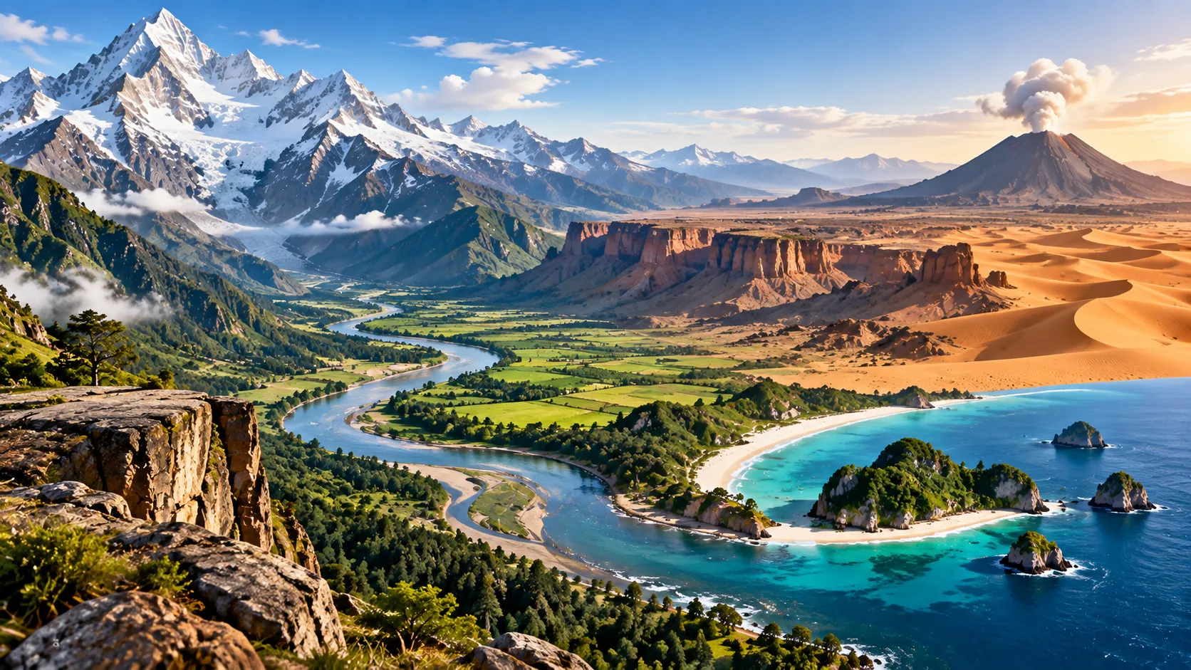
Landforms are natural shapes and features on Earth's surface. Mountains, valleys, plains, plateaus, canyons, dunes, hills, and basins are all landforms. Together, these features create the terrain of a region.
Terrain describes the physical character of the land, including its elevation, slope, roughness, and arrangement of landforms. A region may have mountainous, flat, rolling, rocky, or desert terrain.
Landforms are not permanent. Earth's surface is continually reshaped by tectonic movement, volcanic activity, flowing water, glaciers, wind, weathering, erosion, deposition, and gravity. The U.S. National Park Service describes landforms as products of both internal geological activity and surface processes involving water, wind, ice, and gravity.
Understanding landforms helps students interpret maps, climate, ecosystems, settlement patterns, agriculture, transportation, natural hazards, and Earth's geological history.
Learning Objectives
After studying this guide, you should be able to:
Define landform, terrain, elevation, relief, and topography.
Identify major landforms such as mountains, plateaus, plains, valleys, hills, and basins.
Explain how tectonics, weathering, erosion, and deposition shape terrain.
Compare river, glacial, desert, volcanic, and karst landforms.
Explain how landforms affect climate, ecosystems, settlement, and transportation.
Recognize major terrain features on physical and topographic maps.
What Is a Landform?
A landform is a natural feature of Earth's solid surface.
Landforms range from enormous mountain systems extending thousands of kilometers to small dunes, ridges, and depressions.
Examples include:
Landform | Basic Description |
Mountain | High, steep area of land |
Hill | Raised area lower and usually less steep than a mountain |
Plateau | Elevated area with a broad, relatively level surface |
Plain | Broad area of relatively flat or gently rolling land |
Valley | Low area between higher ground |
Canyon | Deep, narrow valley with steep sides |
Basin | Low area often surrounded by higher terrain |
Dune | Hill or ridge of wind-deposited sand |
Mesa | Flat-topped elevated landform with steep sides |
Butte | Isolated steep-sided hill with a relatively small flat top |
Landforms often occur together. A mountain range may contain peaks, ridges, valleys, cliffs, and plateaus within the same landscape.
What Is Terrain?
Terrain refers to the overall physical form of the land.
When geographers describe terrain, they may consider:
· Elevation
· Slope
· Relief
· Surface roughness
· Drainage
· Rock type
· Arrangement of landforms
For example, a region containing steep peaks and narrow valleys has mountainous terrain, while a wide area with little change in elevation has flat terrain.
Elevation, Relief, and Topography
These terms describe different aspects of terrain.
Elevation
Elevation is the height of a location above a reference level, usually mean sea level.
A mountain summit may have an elevation of several thousand meters.
Relief
Relief is the difference in elevation between high and low points in an area.
A flat plain has low relief. A rugged mountain region has high relief.
Topography
Topography describes the shape and arrangement of surface features in an area.
Topographic maps show features such as elevation, slopes, valleys, ridges, rivers, and mountains.
The Forces That Create Landforms
Earth's landscapes develop through interactions between forces originating inside Earth and processes acting on its surface.
A useful distinction is:
Internal processes build and deform terrain.
External processes wear down, transport, and reshape terrain.
Internal processes include tectonic movement and volcanism. External processes include weathering, erosion, transportation, deposition, glaciers, rivers, waves, wind, and gravity.
Plate Tectonics and Landforms
Earth's rigid outer layer is divided into tectonic plates that slowly move relative to one another.
Plate movement can produce:
· Mountain ranges
· Rift valleys
· Volcanoes
· Fault scarps
· Ocean basins
· Earthquakes
The National Park Service explains that plate movement can deform rocks through folding, faulting, extension, and large-scale mountain building.
Fold Mountains
Fold mountains can develop where tectonic forces compress and fold layers of rock.
When continental masses collide, crust may be shortened, thickened, folded, faulted, and uplifted.
The Himalayas are a famous example of a major mountain system associated with continental collision.
Fault-Block Mountains
Fault-block mountains form when large sections of Earth's crust move relative to one another along faults.
Some blocks rise while neighboring areas may drop, producing alternating mountains and basins.
Volcanic Mountains
Volcanic mountains form when magma reaches Earth's surface and lava, ash, and other volcanic materials accumulate.
Some volcanic mountains form at plate boundaries, while others develop above hot spots.
Mountains
A mountain is a prominent area of elevated land, usually with steep slopes and significant relief.
Mountains may occur individually, but many form part of a mountain range.
Several connected ranges may form an even larger mountain system.
Mountains influence human and natural systems. They can affect rainfall, create habitats at different elevations, contain mineral resources, feed rivers, and make transportation difficult.
Mountain Passes
A mountain pass is a relatively low route through a mountain range.
Passes have historically been important for migration, trade, roads, and military movement.
Hills
A hill is an elevated area that is generally lower and less steep than a mountain.
There is no universal elevation that perfectly separates hills from mountains. Local naming and geographic tradition often influence which term is used.
Groups of hills can form rolling terrain with repeated rises and depressions.
Plateaus
A plateau is a broad area of elevated land that is relatively level or gently rolling compared with surrounding terrain.
Plateaus can form through:
· Tectonic uplift
· Volcanic lava flows
· Erosion of surrounding land
· Combinations of geological processes
A plateau may stand hundreds or thousands of meters above nearby lowlands.
Rivers can later cut deep valleys and canyons into an elevated plateau.
Plains
A plain is a broad region with relatively little change in elevation.
Plains may be almost flat or gently rolling.
They can form through sediment deposition by rivers, erosion of older landscapes, glacial processes, or the accumulation of sediments over long periods.
Because plains are often easier to farm, build on, and travel across than steep terrain, many densely settled regions have developed on them.
Floodplains
A floodplain is relatively flat land beside a river that may be covered by water during floods.
When floodwater spreads beyond a river channel, its speed decreases and sediment can be deposited across the floodplain.
Floodplains often contain fertile soils, making them attractive for agriculture, but they also face flood hazards.
Valleys
A valley is an elongated low area between hills, mountains, or other higher terrain.
Different processes create different valley shapes.
V-Shaped Valleys
Rivers cutting downward into rock often create valleys with a V-shaped cross-section.
These are common in mountainous regions where streams have enough energy to erode downward rapidly.
U-Shaped Valleys
Glaciers can widen and deepen existing valleys, producing broad U-shaped valleys with steep sides.
Glaciers are moving bodies of ice capable of carving landscapes and transporting large amounts of rock and sediment.
Rift Valleys
A rift valley can form where Earth's crust is stretched and faulted.
Blocks of crust drop relative to surrounding land, producing an elongated depression.
Canyons and Gorges
A canyon is a deep valley with steep sides.
Many canyons are created when rivers cut downward through rock over long periods, particularly where land has been uplifted.
A gorge is also a deep, narrow valley with steep sides. The words canyon and gorge overlap considerably, and naming practices vary between regions.
Basins
A basin is an area of land that is lower than surrounding terrain.
Some basins form through tectonic movements. Others develop through erosion or volcanic processes.
The word basin is also used in hydrology.
A drainage basin, or watershed, is the entire area from which water drains into a particular river or other body of water. Neighboring drainage basins are separated by higher ground called a drainage divide.
River-Created Landforms
Rivers are major landscape-shaping forces.
They:
Erode → Transport → Deposit
Fast-moving water can remove rock and sediment. Rivers transport this material downstream and deposit it where their energy decreases.
River landforms include:
· Valleys
· Canyons
· Floodplains
· Natural levees
· Meanders
· Oxbow lakes
· River terraces
· Deltas
· Alluvial fans
The National Park Service identifies river erosion, sediment transportation, and deposition as major processes shaping land surfaces.
Meanders
A meander is a curve or bend in a river.
Erosion tends to occur along the faster-flowing outer side of a bend, while sediment can accumulate along the inner side.
Repeated change can eventually separate a bend from the main channel.
Oxbow Lakes
An oxbow lake forms when a river abandons a meander loop, leaving behind a curved body of water.
Glacial Landforms
Glaciers move slowly under their own weight.
As they move, they erode rock, transport debris, and deposit sediment.
Glacial landforms include:
· U-shaped valleys
· Cirques
· Arêtes
· Horns
· Moraines
· Glacial lakes
· Fjords
A moraine is an accumulation of material transported and deposited by a glacier.
A cirque is a bowl-shaped hollow carved near the head of a mountain glacier.
An arête is a narrow, sharp ridge that can develop between glacial valleys or cirques.
Desert and Wind-Created Landforms
Wind is an important geomorphic force, especially in dry environments with loose sediment and limited vegetation.
Wind can erode, transport, and deposit sand, silt, and dust.
Sand Dunes
A dune is a mound or ridge of sand created by wind deposition.
Dunes may occur in deserts and along sandy coasts.
Their shapes depend on factors such as:
· Wind direction
· Wind strength
· Sand supply
· Vegetation
· Surface conditions
Dunes are dynamic rather than permanent. Wind can move individual grains and gradually shift entire dune systems.
Loess
Loess is a deposit of fine, wind-blown sediment, especially silt.
Thick loess deposits can create fertile soils, although they may also be highly vulnerable to erosion.
Karst Terrain
Karst is terrain produced mainly by the dissolution of soluble rock.
It commonly develops in limestone but can also occur in rocks such as gypsum and marble.
Karst landscapes can contain:
· Caves
· Sinkholes
· Sinking streams
· Springs
· Underground drainage
Water enters cracks in soluble bedrock and gradually enlarges them through chemical dissolution.
Sinkholes
A sinkhole is a depression or hole in the ground associated with subsurface dissolution or collapse.
Some form gradually, while others can collapse suddenly.
Mesas and Buttes
Mesas and buttes are common in landscapes where horizontal rock layers have been eroded unevenly.
A mesa is an elevated, flat-topped landform with steep sides.
A butte is similar but smaller, with a top that is narrower relative to its height.
A simplified erosional sequence is:
Plateau → Mesa → Butte → Smaller remnant
The exact evolution of real landscapes can be more complicated, but this sequence is useful for understanding differential erosion.
Weathering, Erosion, and Deposition
These three processes are essential for understanding landform development.
Weathering
Weathering breaks rock down in place.
Physical weathering breaks material into smaller pieces without changing its basic chemical composition.
Chemical weathering alters minerals through chemical reactions.
Erosion
Erosion removes and transports weathered material.
Major agents of erosion include:
· Running water
· Glaciers
· Wind
· Waves
· Gravity
Deposition
Deposition occurs when transported material is dropped.
Depositional processes create features such as floodplains, dunes, river bars, deltas, and some coastal landforms.
Remember:
Weathering breaks.
Erosion moves.
Deposition drops.
Landforms and Climate
Terrain can strongly influence climate.
Mountains force moving air upward. As air rises, it cools and may produce precipitation on the windward side.
The opposite side can receive much less precipitation, producing a rain-shadow effect.
Elevation also affects temperature. Higher elevations are generally cooler than nearby lower elevations.
As a result, a mountain may contain very different ecological zones from its base to its summit.
Landforms and Human Settlement
Terrain affects where people live and how they use land.
Flat or gently sloping regions often make it easier to:
· Build cities
· Construct roads
· Farm large areas
· Develop railways
· Build airports
Mountainous terrain can make transportation and construction more difficult, but mountains may also provide tourism, hydropower, forests, minerals, pasture, and freshwater.
River valleys and plains have historically attracted settlement because of their water supplies, fertile soils, and transportation opportunities.
Reading Terrain on Maps
Physical maps use color, shading, and symbols to represent landforms.
Topographic maps provide more detailed terrain information through contour lines.
A contour line joins points of equal elevation.
Important rules include:
Closely spaced contour lines = steep slope
Widely spaced contour lines = gentle slope
Closed contour loops often indicate a hill or mountain
Contour patterns can also help identify valleys, ridges, depressions, and cliffs.
Common Mistakes
Mistake 1: Weathering and Erosion Mean the Same Thing
False. Weathering breaks rock down, while erosion removes and transports material.
Mistake 2: All Mountains Form in the Same Way
False. Mountains can develop through folding, faulting, volcanism, uplift, and combinations of processes.
Mistake 3: Plateaus Are Low, Flat Areas
False. A plateau is relatively flat but elevated. A plain is generally associated with lower-relief terrain.
Mistake 4: Every Valley Is Created by a River
False. Rivers, glaciers, tectonic activity, and other processes can create valleys.
Mistake 5: Deserts Are Always Flat
False. Desert landscapes can contain mountains, plateaus, canyons, dunes, mesas, basins, and rocky plains.
Mistake 6: Landforms Never Change
False. Landforms continue to evolve through erosion, deposition, weathering, tectonics, volcanism, and gravity.
Memory Tips
Remember the core landforms:
Mountain = high and steep
Plateau = high and relatively flat
Plain = broad and relatively flat
Valley = low between high areas
Basin = low area surrounded by higher terrain
Canyon = deep, steep-sided valley
For Earth's shaping processes:
Tectonics build and deform
Weathering breaks
Erosion transports
Deposition builds
For valleys:
River → V-shaped
Glacier → U-shaped
Summary
Landforms are natural shapes on Earth's surface, while terrain describes the overall physical character of an area. Important terrain concepts include elevation, relief, slope, and topography. Mountains, hills, plateaus, plains, valleys, canyons, basins, dunes, mesas, and buttes form through different combinations of geological processes.
Plate tectonics can create mountains, faults, volcanoes, and rift valleys. Rivers carve valleys and canyons while creating floodplains and other depositional features. Glaciers carve U-shaped valleys and produce distinctive mountain features. Wind creates dunes and other aeolian landforms, while the dissolution of soluble rock produces karst landscapes containing caves and sinkholes.
Landforms also influence climate, water movement, ecosystems, agriculture, transportation, and human settlement. Learning how to identify terrain therefore provides important clues about both Earth's geological history and how people interact with the physical environment.
FAQ
1. What is a landform?
A landform is a natural physical feature of Earth's surface, such as a mountain, plain, valley, plateau, or dune.
2. What is terrain?
Terrain is the overall physical character of the land, including its slopes, elevation, relief, and landforms.
3. What is the difference between a plateau and a plain?
Both can have relatively level surfaces, but a plateau is elevated above surrounding land, while a plain generally has relatively low relief.
4. How are mountains formed?
Mountains can form through tectonic collision, folding, faulting, volcanic activity, uplift, or combinations of these processes.
5. What is the difference between weathering and erosion?
Weathering breaks down rock in place. Erosion removes and transports the resulting material.
6. Why are river valleys often V-shaped?
Flowing water erodes downward into the landscape, producing a narrow valley whose sides slope toward the river.
7. Why are glacial valleys often U-shaped?
A glacier fills a large part of a valley and erodes both its floor and sides, creating a wider, rounded profile.
8. What is karst terrain?
Karst is a landscape produced by the dissolution of soluble rock and commonly contains caves, sinkholes, springs, and underground drainage.
9. What is relief in geography?
Relief is the difference in elevation between the highest and lowest parts of an area.
10. How do contour lines show terrain?
Contour lines connect points of equal elevation. Their spacing and patterns reveal slopes, hills, valleys, ridges, and other terrain features.
Key Takeaways
· Landforms are individual surface features, while terrain describes the overall shape and character of the land.
· Mountains, plateaus, plains, valleys, basins, canyons, dunes, and other landforms develop through different geological processes.
· Plate tectonics, weathering, erosion, deposition, rivers, glaciers, wind, and volcanism continually reshape Earth's surface.
· River valleys are commonly V-shaped, while glacial valleys are typically U-shaped.
· Terrain strongly influences climate, ecosystems, agriculture, transportation, and patterns of human settlement.
References
1. U.S. National Park Service. Park Landforms. Overview of geological processes responsible for shaping Earth's landforms.
2. U.S. National Park Service. Plate Tectonics & Our National Parks. Explains tectonic plates and their role in creating mountains, valleys, volcanoes, and ocean basins.
3. U.S. National Park Service. Tectonic Landforms and Mountain Building. Covers faulting, folding, extension, and tectonic mountain formation.
4. U.S. National Park Service. River Systems and Fluvial Landforms. Covers river erosion, transportation, deposition, floodplains, and drainage basins.
5. U.S. National Park Service. Glaciers and Glacial Landforms. Explains how moving ice carves valleys and transports sediment.
6. U.S. National Park Service. Aeolian (Dunes) Landforms. Describes erosion, transportation, and deposition of sediment by wind.
7. U.S. National Park Service. Karst Landscapes. Explains the development of caves, sinkholes, springs, and underground drainage in soluble rock.
8. U.S. National Park Service. Erosional and Depositional Features. Overview of landforms produced by water, wind, ice, and gravity.