
Introduction
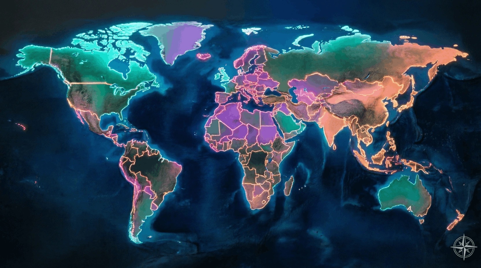
A country is a territory commonly understood as having its own political identity, population, government, and relationship with other countries. Countries are among the basic units used to organize the political map of the world.
A border is a boundary separating territories under different political authorities. Borders may divide countries, administrative regions, or other jurisdictions. They can follow rivers, mountains, coastlines, surveyed lines, or historical agreements.
Countries and borders matter because they affect citizenship, law, trade, travel, security, natural resources, transportation, and international relations. Yet political geography is not always simple. Some boundaries are disputed, some territories have unusual political status, and the words country, state, and nation do not always mean exactly the same thing.
As of 2026, the United Nations has 193 Member States. UN materials also identify the Holy See and the State of Palestine as two non-member observer States, producing the commonly used total of 195 states in UN-based country lists.
Learning Objectives
After studying this guide, you should be able to:
Distinguish countries, states, nations, territories, and sovereign states.
Explain how international borders are created, mapped, and marked.
Identify natural, geometric, land, and maritime boundaries.
Explain enclaves, exclaves, landlocked states, and border crossings.
Describe territorial seas, exclusive economic zones, and maritime boundaries.
Understand why some borders are disputed and how international law can help resolve disagreements.
Country, State, and Nation
These words are often used interchangeably in everyday conversation, but they describe different ideas.
Country
Country is a broad geographic and political term.
It usually refers to a recognized territory with a population and political organization.
State
In international relations, a state is a political entity exercising authority over a territory and population and participating in relations with other states.
The word can be confusing because it also describes subdivisions inside some countries, such as the states of India, Australia, or the United States.
For international geography, sovereign state is the more precise term.
Nation
A nation is primarily a community of people connected through some combination of shared identity, history, culture, language, traditions, or political consciousness.
A nation does not necessarily have its own sovereign country.
Memory Tip
Country = place
State = political authority
Nation = people and identity
These categories often overlap, but not always.
Sovereignty
Sovereignty means supreme political authority within a territory combined with independence in external relations.
A sovereign state normally controls matters such as:
Laws
Government institutions
Citizenship
International agreements
Border administration
Recognition is nevertheless a diplomatic and legal issue rather than something determined by geography alone.
The United Nations itself does not independently "recognize countries" in the way another state might. UN guidance explains that recognition of a state or government is an act that other states and governments may grant or withhold.
How Many Countries Are There?
This question has a simple classroom answer and a more complicated political answer.
The United Nations currently has:
193 Member States
In addition, two entities have UN non-member observer-state status:
Holy See
State of Palestine
That produces the frequently used figure:
193 + 2 = 195
However, different lists can produce different totals because diplomatic recognition and territorial status are not identical everywhere. A good quiz question should therefore specify whether it is asking about UN Member States or a broader definition of countries.
What Is a Border?
A border, or international boundary, separates the territories of neighboring states.
A boundary may exist legally even when nothing visible appears on the ground.
For example, a border might run through:
A desert
A forest
A lake
A mountain range
A river
A city
Open countryside
Some boundaries are heavily marked with fences and checkpoints. Others are crossed with relatively little visible infrastructure.
Boundary vs. Frontier
These words can have slightly different meanings.
A boundary usually means the precise legal line separating territories.
A frontier traditionally refers to a broader border region or zone.
Modern political maps generally represent boundaries as lines, even though the actual border environment may extend across a wider landscape.
How Borders Are Created
Borders can develop through many historical processes.
These include:
Treaties
Wars and peace settlements
Colonial administration
Independence
Unification
Separation of states
International arbitration
Court judgments
Negotiated agreements
Many modern borders reflect layers of history rather than purely physical geography.
A straight border on a map therefore does not mean the boundary is arbitrary in every legal sense. It may reflect a negotiated coordinate, survey line, colonial administrative boundary, or treaty provision.
Delimitation and Demarcation
Two useful terms help explain border-making.
Delimitation
Delimitation means legally defining where a boundary should run, often in a treaty, judgment, map, or set of coordinates.
Demarcation
Demarcation means physically marking that boundary on the ground.
Markers can include:
Posts
Pillars
Fences
Walls
Signs
Survey monuments
A boundary may be legally delimited before it is fully demarcated.
Natural Boundaries
Some borders use physical geographic features.
Examples include:
Rivers
Mountain ranges
Lakes
Watersheds
These are sometimes called natural boundaries.
However, the term can be misleading because people still have to decide precisely how the legal boundary relates to the feature.
For a river boundary, questions may include whether the border follows:
One bank
The river's center
A navigable channel
Physical geography can also change over time.
Geometric Boundaries
A geometric boundary follows a surveyed line rather than a major physical feature.
It may follow:
Latitude
Longitude
A straight line between coordinates
Geometric boundaries are especially noticeable on political maps because they can appear remarkably straight.
The legal line, however, still has to be surveyed accurately on Earth's curved surface.
Border Markers and Checkpoints
A border marker shows the location of a boundary.
A border checkpoint is a controlled crossing point where authorities may inspect:
Passports
Visas
Vehicles
Goods
Customs declarations
Not every section of every border has a checkpoint.
Countries determine border-crossing procedures through their own laws and international agreements.
Customs and Immigration
These terms describe related but different border functions.
Immigration Control
Immigration authorities deal mainly with people.
Questions include:
Who may enter?
How long may they remain?
What documents are required?
Customs Control
Customs authorities deal mainly with goods.
They may enforce rules concerning:
Imports
Exports
Taxes
Restricted goods
Commercial shipments
A traveler can therefore pass immigration inspection and customs inspection as separate processes.
Landlocked Countries
A landlocked country has no direct territorial access to an open sea or ocean.
Examples include countries in central Asia, central Europe, central Africa, and other inland regions.
The United Nations identifies 44 landlocked countries worldwide, of which 32 are classified as Landlocked Developing Countries (LLDCs).
Landlocked countries often depend on transport routes through neighboring states to reach seaports.
This can affect:
Freight costs
Trade times
Infrastructure planning
Diplomatic cooperation
Landlocked does not mean isolated. Railways, highways, rivers, air transport, and international transit agreements can connect inland countries to global markets.
Double-Landlocked Countries
A double-landlocked country is surrounded only by other landlocked countries.
Reaching an open sea therefore requires crossing at least two international borders.
Only a very small number of states fit this geographic definition.
This is a favorite geography quiz concept because it tests both political and physical geography.
Enclaves
An enclave is a territory completely surrounded by the territory of another state.
For example, a sovereign country entirely surrounded by one other country forms a sovereign enclave.
Enclaves can also exist at subnational levels.
Exclaves
An exclave is a part of a political territory separated from its main portion by another territory or territories.
Think of the distinction from two viewpoints:
Enclave = surrounded
Exclave = separated
Some territories can be both an enclave and an exclave, depending on which relationship is being described.
Borders Inside Cities
International boundaries do not always run through remote countryside.
Some divide:
Urban areas
Roads
Buildings
Communities
This can create unusual arrangements in which everyday life operates very close to an international boundary.
These situations demonstrate that borders are political and legal structures layered onto human settlements and landscapes.
Maritime Borders
Countries with coastlines can also possess legal rights in adjacent waters.
The United Nations Convention on the Law of the Sea, or UNCLOS, provides the main international framework for maritime zones.
These zones do not all grant the same rights.
Territorial Sea
A coastal state may establish a territorial sea extending up to:
12 nautical miles from its baseline
Within the territorial sea, state sovereignty extends to the water, seabed, subsoil, and airspace, subject to international law including rules concerning passage.
One nautical mile equals approximately:
1.852 kilometers
Therefore:
12 nautical miles ≈ 22.2 km
Contiguous Zone
Beyond the territorial sea, UNCLOS provides for a contiguous zone that may extend to:
24 nautical miles from the baseline
Within it, a coastal state has certain enforcement powers relating to matters such as customs, taxation, immigration, and sanitation.
Exclusive Economic Zone
An Exclusive Economic Zone, or EEZ, may extend as far as:
200 nautical miles from coastal baselines
Within its EEZ, a coastal state has sovereign rights relating particularly to natural resources and certain economic activities.
It does not possess the same complete sovereignty over an EEZ that it does over its territorial sea. Other states retain rights such as navigation and overflight under UNCLOS.
Memory Tip
Territorial sea = up to 12 nautical miles
Contiguous zone = up to 24
EEZ = up to 200
Continental Shelf
The continental shelf has a special legal meaning under UNCLOS.
It concerns the seabed and subsoil beyond the territorial sea.
A coastal state's continental-shelf rights can extend to at least 200 nautical miles in relevant circumstances and may extend farther where the geological continental margin and UNCLOS rules allow it.
Continental-shelf rights concern seabed and subsoil resources, not ownership of the entire water column above.
What Happens When Maritime Claims Overlap?
Two countries may be so close together that each could theoretically claim maritime zones extending into the same area.
Their claims must then be delimited.
States may negotiate maritime boundaries through agreements.
Legal disputes may also be addressed through international judicial or arbitral procedures when the states concerned accept the relevant jurisdiction.
Border Disputes
A border dispute occurs when states disagree about the location, interpretation, or legal status of a boundary.
Disagreements can involve:
Land territory
Rivers
Islands
Maritime zones
Historical treaties
Survey coordinates
A map showing one boundary does not by itself settle the underlying legal issue.
Different governments or international organizations may use different cartographic conventions where claims are contested.
International Court of Justice
The International Court of Justice, or ICJ, is the principal judicial organ of the United Nations.
States may submit certain disputes to the Court when the necessary jurisdictional conditions are satisfied.
The ICJ has handled numerous cases concerning land boundaries, maritime delimitation, islands, and sovereignty. Its records include cases such as the Benin–Niger frontier dispute and various land-and-maritime delimitation proceedings.
The Court cannot simply take over every boundary dispute. States must have accepted its jurisdiction in an applicable way.
Borders and Maps
Political maps make boundaries look precise and permanent.
Reality can be more complicated.
Maps may differ because of:
Scale
Survey accuracy
Changing political circumstances
Territorial disputes
Different cartographic policies
This is why reputable political maps often include disclaimers stating that their boundary presentation does not necessarily represent a legal judgment on disputed territory.
Borders Change Over Time
The political map is not fixed permanently.
Borders can change because of:
Treaties
Independence
State dissolution
Unification
Territorial exchange
Court or arbitration decisions
Negotiated adjustments
For example, the UN grew from 51 original Member States in 1945 to 193 today, reflecting decolonization, state formation, and other major political changes during the twentieth and early twenty-first centuries.
Historical maps are therefore snapshots of particular moments rather than timeless representations.
Common Mistakes
Mistake 1: Country, Nation, and State Always Mean the Same Thing
False.
Their meanings overlap, but country is mainly geographic-political, state emphasizes political authority, and nation emphasizes collective identity.
Mistake 2: There Are Exactly 195 Countries Under Every Definition
False.
There are 193 UN Member States plus two UN non-member observer States. Broader country totals can vary depending on the recognition criteria being used.
Mistake 3: Every Border Is a Fence or Wall
False.
A border is fundamentally a legal boundary. Many boundaries have no continuous physical barrier.
Mistake 4: Natural Borders Need No Human Definition
False.
Even rivers and mountain ranges require legal definitions explaining exactly where the boundary lies.
Mistake 5: A Country Owns Everything Within 200 Nautical Miles of Its Coast
False.
An EEZ provides specific sovereign rights and jurisdiction, especially regarding resources. It is not legally equivalent to territorial sovereignty.
Mistake 6: Landlocked Means Surrounded by One Country
False.
Landlocked simply means lacking direct territorial access to an open sea or ocean.
Memory Tips
For political geography:
Country = territory
State = government and sovereignty
Nation = people and identity
For borders:
Delimitation = define the line
Demarcation = mark the line
For unusual territories:
Enclave = enclosed
Exclave = excluded/separated from the main territory
For maritime zones:
12 = territorial sea
24 = contiguous zone
200 = EEZ
Summary
Countries and borders form the basic political geography of the modern world.
A country is a territorial-political unit, while a sovereign state emphasizes political authority and independence. A nation refers primarily to a community linked by shared identity and history.
Borders separate political territories. They may follow physical features such as rivers and mountains or geometric lines based on coordinates. Delimitation legally defines a boundary, while demarcation physically marks it.
Political geography also includes landlocked countries, enclaves, exclaves, customs zones, and border crossings.
Coastal states possess several different maritime zones. Under UNCLOS, territorial seas may extend up to 12 nautical miles, contiguous zones to 24 nautical miles, and EEZs generally to 200 nautical miles. These zones provide different categories of rights and should not be treated as identical.
Borders can also be disputed. States may resolve disagreements through negotiation, treaties, arbitration, or international courts when the necessary legal conditions apply.
Political maps are therefore more than collections of lines. Each boundary reflects geography, history, law, diplomacy, and human decisions.
FAQ
1. How many UN Member States are there?
There are currently 193 UN Member States.
2. Why do people often say there are 195 countries?
Because the 193 UN Member States are often counted together with the two UN non-member observer States, the Holy See and the State of Palestine.
3. What is a sovereign state?
A sovereign state is a political entity exercising authority over its territory and population and acting independently in international relations.
4. What is the difference between a border and a frontier?
A border or boundary usually refers to a legal dividing line, while frontier can describe the broader region surrounding it.
5. What is a landlocked country?
A landlocked country has no direct territorial access to an open sea or ocean.
6. What is an enclave?
An enclave is a territory completely surrounded by another political territory.
7. What is an exclave?
An exclave is a part of a territory geographically separated from its main portion.
8. How wide can a territorial sea be?
Under UNCLOS, a state may establish a territorial sea extending up to 12 nautical miles from its baselines.
9. What is an EEZ?
An Exclusive Economic Zone is a maritime zone extending up to 200 nautical miles in which a coastal state has important rights over natural resources and certain economic activities.
10. Can international courts decide border disputes?
Yes, in appropriate cases. The International Court of Justice can decide disputes between states when the states concerned have accepted its jurisdiction.
Key Takeaways
The world currently has 193 UN Member States, while two additional entities hold UN non-member observer-state status.
Country, state, and nation describe related but different geographic, political, and cultural concepts.
International borders may follow physical features or surveyed lines; delimitation defines them legally and demarcation marks them physically.
Landlocked states, enclaves, and exclaves create unusual geographic relationships between countries and territories.
International maritime law distinguishes territorial seas, contiguous zones, EEZs, and continental shelves, each with different legal rights.
References
United Nations. About the United Nations — Member States. UN — 193 Member States
United Nations Group of Experts on Geographical Names. Country Names and UN Status. UN Digital Library — 193 Member States and Two Observer States
United Nations. Flagging the United Nations. UN — Member and Observer State Flags
United Nations Division for Ocean Affairs and the Law of the Sea. United Nations Convention on the Law of the Sea. UN — UNCLOS Territorial Sea Rules
United Nations Division for Ocean Affairs and the Law of the Sea. Exclusive Economic Zone. UN — UNCLOS EEZ Rules
United Nations Division for Ocean Affairs and the Law of the Sea. Continental Shelf. UN — UNCLOS Continental Shelf Rules
United Nations Office of the High Representative for the Least Developed Countries, Landlocked Developing Countries and Small Island Developing States. UN-OHRLLS — Landlocked Developing Countries
International Court of Justice. Contentious Jurisdiction. ICJ — How Interstate Disputes Reach the Court
International Court of Justice. Frontier Dispute (Benin/Niger). ICJ — Example of International Boundary Delimitation