
Introduction
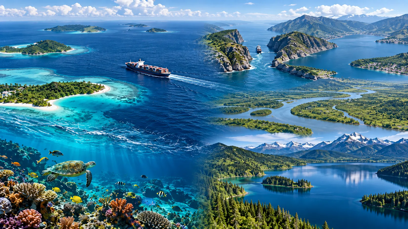
Water covers most of Earth's surface and occurs in many different forms. Oceans, seas, bays, gulfs, straits, lakes, rivers, estuaries, lagoons, and reservoirs are all water bodies, but each term describes a different geographic setting.
The world's ocean is physically interconnected, although geographers commonly divide it into the Pacific, Atlantic, Indian, Southern, and Arctic Oceans. UNESCO describes Earth as having one global ocean with several major ocean basins, covering approximately 70 percent of the planet's surface.
Understanding water bodies is important for physical geography, transportation, international trade, climate, ecosystems, settlement, and political geography. Straits and narrow waterways are especially important because they can connect major seas and oceans while concentrating global shipping into small geographic areas.
Learning Objectives
After studying this guide, you should be able to:
· Distinguish oceans, seas, gulfs, bays, straits, channels, and sounds.
· Explain the differences among lakes, reservoirs, rivers, lagoons, and estuaries.
· Identify important seas and straits around the world.
· Explain why narrow maritime passages are strategically important.
· Describe how water bodies connect through drainage basins and the water cycle.
· Avoid common mistakes involving geographic names such as the Caspian Sea and Dead Sea.
What Is a Water Body?
A water body is a recognizable accumulation or flow of water on or near Earth's surface.
Water bodies include:
· Oceans
· Seas
· Gulfs
· Bays
· Straits
· Channels
· Lakes
· Ponds
· Rivers
· Streams
· Reservoirs
· Lagoons
· Estuaries
· Wetlands
They differ in size, salinity, depth, movement, location, and connection with other bodies of water.
Surface water is also connected with groundwater. USGS notes that rivers, lakes, reservoirs, wetlands, and estuaries frequently interact with groundwater systems rather than functioning as completely separate water supplies.
Oceans
An ocean is one of Earth's largest interconnected bodies of salt water.
The five commonly recognized ocean basins are:
1. Pacific Ocean
2. Atlantic Ocean
3. Indian Ocean
4. Southern Ocean
5. Arctic Ocean
These names divide the global ocean geographically, but the water itself is interconnected.
UNESCO notes that the global ocean covers roughly 70 percent of Earth's surface and contains about 97 percent of Earth's water.
The Pacific Ocean
The Pacific is the largest ocean basin.
It lies between Asia and Australia on one side and North and South America on the other. It contains thousands of islands and many of Earth's deepest ocean trenches.
The Atlantic Ocean
The Atlantic separates the Americas from Europe and Africa.
It has historically been an important route for migration, exploration, trade, and transportation.
The Indian Ocean
The Indian Ocean lies mainly between Africa, Asia, Australia, and the Southern Ocean.
Important shipping routes through it connect Asia, the Middle East, Africa, and Europe.
The Southern Ocean
The Southern Ocean surrounds Antarctica.
Its powerful currents play an important role in global ocean circulation and climate.
The Arctic Ocean
The Arctic Ocean surrounds the North Pole and is the smallest of the five commonly recognized ocean basins.
Much of it is seasonally covered by sea ice.
What Is a Sea?
A sea is generally a subdivision of the ocean that is smaller than an ocean and often partly enclosed by land.
NOAA explains that seas are normally smaller than oceans and usually occur where land and ocean meet. Many are partly surrounded by land.
Examples include:
· Mediterranean Sea
· Caribbean Sea
· Baltic Sea
· Black Sea
· Red Sea
· Arabian Sea
· South China Sea
· Bering Sea
· North Sea
The Mediterranean Sea
The Mediterranean lies between Europe, Africa, and Asia.
It connects with the Atlantic Ocean through the Strait of Gibraltar.
Because it is almost surrounded by land, it is an excellent example of a semi-enclosed sea.
The Caribbean Sea
The Caribbean Sea lies southeast of the Gulf of Mexico and east of Central America.
It contains many islands, including parts of the Greater and Lesser Antilles.
The Red Sea
The Red Sea lies between northeastern Africa and the Arabian Peninsula.
It connects to the Gulf of Aden through the Bab el-Mandeb and, through the Suez Canal, to the Mediterranean Sea.
The Sargasso Sea: An Important Exception
Not every sea is enclosed by land.
The Sargasso Sea in the North Atlantic is unusual because its boundaries are defined largely by ocean currents rather than surrounding continents or islands. NOAA specifically identifies it as an exception to the usual geographic description of a sea.
Sea vs. Ocean
The simplest distinction is:
Ocean = enormous global saltwater basin
Sea = smaller subdivision of the ocean, usually partly enclosed by land
However, geographic naming developed historically, so not every named water body fits a perfect scientific classification.
What Is a Strait?
A strait is a naturally occurring narrow body of water connecting two larger bodies of water.
It usually separates two land areas.
Think:
Land — Strait — Land
while water flows or provides passage between larger water bodies.
Examples include:
Strait | Connects / Separates |
Strait of Gibraltar | Atlantic Ocean and Mediterranean Sea |
Strait of Hormuz | Persian Gulf and Gulf of Oman |
Strait of Malacca | Waters between the Indian and Pacific maritime systems |
Bering Strait | Arctic and Pacific regions; separates Asia and North America |
Bosporus | Black Sea and Sea of Marmara |
Dardanelles | Sea of Marmara and Aegean Sea |
Why Straits Matter
Straits can become major transportation chokepoints because ships traveling between large regions may have to pass through relatively narrow waterways.
They can therefore be important for:
· International trade
· Energy transportation
· Naval strategy
· Fishing
· Regional security
· Communication cables
International law gives special attention to certain straits used for international navigation. The United Nations Convention on the Law of the Sea contains a separate section governing such straits and transit passage.
Strait vs. Channel
A channel is a navigable passage of water.
Like a strait, it may occur between two land areas. The terms overlap considerably, and historical naming means there is no simple worldwide size rule separating every channel from every strait.
Examples include:
· English Channel
· Mozambique Channel
A useful beginner distinction is:
Strait = naturally narrow connection between larger water bodies
Channel = passage of water, often navigable, with broader usage
Do not assume that every feature named "Channel" is artificial.
The English Channel, for example, is a natural water body.
Canals Are Different
A canal is generally an artificial waterway constructed or significantly engineered by humans.
Famous examples include:
· Suez Canal
· Panama Canal
This gives an important quiz distinction:
Strait = natural
Canal = human-made or heavily engineered
The Suez Canal connects the Mediterranean Sea with the Red Sea, while the Panama Canal provides a shipping route between the Atlantic and Pacific sides of the Americas.
What Is a Bay?
A bay is a body of water partly surrounded by land but connected to a larger water body.
Examples include:
· Bay of Bengal
· Hudson Bay
· Chesapeake Bay
· Bay of Biscay
Bays often provide protected coastal waters and may therefore become important sites for harbors, ports, fisheries, and settlements.
What Is a Gulf?
A gulf is also a portion of a sea or ocean that extends into the land.
Examples include:
· Gulf of Mexico
· Persian Gulf
· Gulf of California
· Gulf of Guinea
· Gulf of Aden
Gulf vs. Bay
There is no universal size rule that perfectly distinguishes a gulf from a bay.
Some gulfs are large, some bays are enormous, and geographic names often reflect history rather than a strict classification system.
The Bay of Bengal, for example, is much larger than many water bodies called gulfs.
Therefore, avoid the oversimplified rule that "gulfs are always larger than bays."
What Is a Sound?
A sound is another geographic term with several uses.
Depending on the region, it can refer to:
· A broad inlet
· A passage between land areas
· A waterway connecting larger water bodies
Examples include Long Island Sound and Puget Sound.
Like bay, gulf, channel, and sea, the word sound is influenced heavily by historical naming conventions.
What Is a Lake?
A lake is a body of water surrounded by land and occupying a depression in the landscape.
Lakes can contain:
· Fresh water
· Salt water
· Brackish water
USGS describes a lake as surface water that has accumulated in a low area relative to the surrounding landscape, commonly supplied by runoff and groundwater.
Lakes can form through:
· Glacial erosion
· Tectonic activity
· Volcanic activity
· River processes
· Landslides
· Coastal processes
· Meteor impacts
· Human dam construction
Freshwater Lakes
Many lakes contain fresh water.
Examples include much of the North American Great Lakes system and Lake Baikal.
Freshwater lakes are important for drinking water, irrigation, fisheries, transportation, recreation, and ecosystems.
USGS identifies lakes, rivers, reservoirs, streams, and freshwater wetlands as major forms of surface freshwater.
Salt Lakes
Some inland lakes contain highly saline water.
Salt can accumulate when water enters a basin but has no major outlet to the ocean. Water evaporates, leaving dissolved minerals behind.
Examples include:
· Great Salt Lake
· Dead Sea
Why Is the Dead Sea Called a Sea?
The Dead Sea is geographically an inland saline lake despite its name.
This illustrates an important rule:
Geographic names do not always match modern scientific classifications.
The same principle applies to several famous water bodies.
Is the Caspian Sea Really a Sea?
The Caspian Sea is the world's largest enclosed inland water body.
Despite being called a sea, it is completely surrounded by land.
Depending on the context, it may be described as an inland sea or as the world's largest lake. Its enormous size and saline water help explain its traditional "sea" name.
For quiz purposes, remember:
Caspian Sea = completely landlocked water body
Dead Sea = saline lake despite its name
What Is a Reservoir?
A reservoir is a body of stored water, often created when people build a dam across a river.
USGS distinguishes natural lakes from reservoirs formed by dams that restrict river flow.
Reservoirs may provide:
· Drinking water
· Irrigation
· Hydroelectric power
· Flood control
· Recreation
Some reservoirs resemble natural lakes but have different origins.
Rivers and Streams
A river is flowing water moving downhill through a channel under the influence of gravity.
Smaller flowing watercourses may be called:
· Streams
· Creeks
· Brooks
There is no universal size boundary separating all rivers, streams, and creeks.
USGS explains that rivers develop as water moves from higher to lower elevations, with small flows combining into larger streams and rivers.
Source and Mouth
The source is where a river begins.
The mouth is where it enters another river, lake, sea, or ocean.
Tributary
A tributary is a smaller river or stream that flows into a larger one.
Confluence
A confluence is the point where two streams or rivers meet.
Drainage Basins and Watersheds
A drainage basin, catchment, or watershed is the area of land from which water drains toward a common outlet.
That outlet could be:
· A river
· A lake
· A bay
· A reservoir
· The ocean
USGS defines a watershed as land that drains streams and rainfall toward a common outlet. Higher ground separating neighboring watersheds forms a drainage divide.
This concept links landforms and water bodies together.
What Is an Estuary?
An estuary is a partially enclosed coastal water body where freshwater from rivers mixes with salt water from the sea.
Because fresh and salt water mix, estuaries often contain brackish water.
Estuaries can be highly productive ecosystems and important nursery habitats for fish and other marine organisms.
They also often attract human settlement because river mouths can provide transportation routes and sheltered coastal locations.
What Is a Lagoon?
A lagoon is a relatively shallow body of water separated from a larger sea or ocean by a barrier.
The barrier may be:
· A sandbar
· Barrier island
· Coral reef
Some lagoons remain connected to the sea through narrow openings.
Lagoon vs. Estuary
Remember:
Estuary = river freshwater mixes with seawater
Lagoon = shallow coastal water separated from the sea by a barrier
A lagoon can contain salty, brackish, or occasionally fresher water depending on its environment.
Inland and Coastal Water Bodies
A useful classification is:
Coastal / Marine | Inland |
Ocean | Lake |
Sea | River |
Bay | Stream |
Gulf | Reservoir |
Strait | Pond |
Estuary | Inland wetland |
Lagoon | Groundwater-fed spring |
Some categories overlap. For example, wetlands occur both inland and along coasts.
Freshwater, Saltwater, and Brackish Water
Freshwater
Freshwater contains relatively little dissolved salt.
It occurs in many rivers, lakes, glaciers, groundwater systems, and wetlands.
Saltwater
Seawater contains much higher concentrations of dissolved salts.
Oceans and most seas contain saltwater.
Brackish Water
Brackish water has a salinity between typical freshwater and seawater.
It commonly occurs in:
· Estuaries
· Lagoons
· River mouths
· Coastal wetlands
Water Bodies and the Water Cycle
Water bodies are not isolated.
Water continually moves through the water cycle by processes including:
· Evaporation
· Condensation
· Precipitation
· Runoff
· Infiltration
· Groundwater flow
· River flow
Water falling as rain in a mountain watershed may eventually travel through streams, a river, an estuary, and finally into the ocean.
UNESCO emphasizes that the ocean is connected to Earth's watersheds through the water cycle, while rivers transport water, sediments, nutrients, salts, and pollutants toward estuaries and the sea.
Why Water Bodies Matter
Water bodies influence nearly every aspect of human and natural geography.
They provide:
· Drinking water
· Irrigation
· Fisheries
· Transportation
· Trade routes
· Hydroelectric power
· Recreation
· Wildlife habitat
They also influence:
· Climate
· Settlement patterns
· Political boundaries
· Agriculture
· Ecosystems
· International relations
Large water bodies can moderate nearby temperatures because water heats and cools more slowly than land.
Strategic Straits and Maritime Chokepoints
Some straits are particularly important because large amounts of shipping must pass through narrow spaces.
Important examples include:
Strait of Hormuz
Connects the Persian Gulf with the Gulf of Oman and wider Arabian Sea.
Strait of Malacca
Provides a major maritime connection between the Indian Ocean region and the seas leading toward the Pacific.
Strait of Gibraltar
Connects the Atlantic Ocean and Mediterranean Sea.
Bab el-Mandeb
Connects the Red Sea and Gulf of Aden.
Bosporus and Dardanelles
Together with the Sea of Marmara, these waterways connect the Black Sea with the Mediterranean maritime system.
Such passages matter because geography can concentrate maritime traffic into restricted corridors. International law contains special provisions for navigation through qualifying international straits.
Seas, Straits, and Political Geography
Water bodies can also form parts of political boundaries.
Coastal states exercise particular legal rights in nearby maritime areas. Under the United Nations Convention on the Law of the Sea, a state may establish a territorial sea extending up to 12 nautical miles from its applicable baseline.
However, maritime geography becomes more complicated when countries face each other across narrow seas and straits.
This makes water bodies important not only in physical geography but also in international law and political geography.
Common Mistakes
Mistake 1: A Sea and an Ocean Are Exactly the Same
Not quite. Seas are generally smaller parts of the global ocean and are often partly enclosed by land.
Mistake 2: Every Body Called a "Sea" Is Part of the Ocean
False.
The Dead Sea is an inland saline lake, and the Caspian Sea is completely enclosed by land.
Mistake 3: A Strait and Canal Are the Same
False.
A strait is naturally occurring, while a canal is constructed or significantly engineered by humans.
Mistake 4: A Gulf Is Always Larger Than a Bay
False.
There is no universal size rule. Historical naming plays a major role.
Mistake 5: Lakes Are Always Freshwater
False.
Some lakes contain salt water.
Mistake 6: Rivers Always Flow Directly Into Oceans
False.
A river may flow into another river, lake, inland basin, sea, wetland, or estuary.
Mistake 7: Surface Water and Groundwater Are Completely Separate
False.
Groundwater and surface water frequently interact. A river may gain water from groundwater, while surface water can also recharge underground aquifers.
Memory Tips
Remember:
Ocean = biggest
Sea = smaller part of ocean
Strait = narrow natural connection
Canal = artificial connection
Bay/Gulf = water extending into land
Lake = water surrounded by land
River = flowing water
Estuary = river + sea
Lagoon = shallow coastal water behind barrier
For straits:
Strait connects water and separates land.
For peninsulas, the reverse idea helps:
Peninsula connects land and is surrounded by water on most sides.
Summary
Oceans, seas, straits, bays, gulfs, lakes, rivers, estuaries, and lagoons are different types of water bodies defined by their size, position, movement, salinity, and relationship with surrounding land.
The five commonly recognized ocean basins are interconnected parts of a single global ocean. Seas are generally smaller subdivisions of this ocean and are commonly partly surrounded by land.
Straits are naturally occurring narrow waterways connecting larger bodies of water, making places such as Gibraltar, Hormuz, Malacca, and the Bosporus important for navigation and trade. Canals serve similar transportation purposes but are human-made or substantially engineered.
Bays and gulfs are coastal inlets, while lakes are inland bodies surrounded by land. Rivers move water downhill through drainage networks. Estuaries form where river water mixes with seawater, while lagoons are shallow coastal bodies separated from the open sea by barriers.
Geographic names are not always strict scientific classifications. The Dead Sea is a saline lake, while the Caspian Sea is an enormous enclosed inland water body. Recognizing these exceptions is especially useful for geography quizzes.
FAQ
1. What is the difference between a sea and an ocean?
An ocean is one of Earth's enormous interconnected saltwater basins. A sea is generally smaller and commonly partly enclosed by land.
2. What is a strait?
A strait is a naturally occurring narrow waterway connecting two larger bodies of water and usually separating two areas of land.
3. What is the difference between a strait and a canal?
A strait is natural. A canal is constructed or significantly engineered by humans.
4. What is the difference between a bay and a gulf?
Both are portions of larger water bodies partly surrounded by land. There is no universal size rule that reliably separates them.
5. Is the Dead Sea really a sea?
Geographically, it is an inland saline lake despite its historical name.
6. Is the Caspian Sea an ocean sea?
No. It is completely enclosed by land and is commonly described as an inland sea or the world's largest lake.
7. What is an estuary?
An estuary is a partly enclosed coastal water body where freshwater from rivers mixes with seawater.
8. What is a lagoon?
A lagoon is shallow water separated from a larger sea or ocean by a reef, barrier island, sandbar, or similar feature.
9. Why are straits important?
They connect larger water bodies and can concentrate shipping through narrow passages, making them important for trade, transportation, strategy, and international law.
10. What is a watershed?
A watershed or drainage basin is the area of land from which water drains toward the same river, lake, bay, or other outlet.
Key Takeaways
Earth has one interconnected global ocean commonly divided into five major ocean basins.
Seas are generally smaller than oceans and are often partly enclosed by land.
A strait is a natural narrow connection between water bodies, while a canal is human-made or extensively engineered.
Lakes, rivers, estuaries, lagoons, gulfs, and bays describe different relationships between water and surrounding land.
Names are not always scientific classifications: the Dead Sea is a lake, and the Caspian Sea is completely landlocked.
References
1. National Oceanic and Atmospheric Administration (NOAA), National Ocean Service. What's the Difference Between an Ocean and a Sea? Explains the geographic distinction between oceans and seas and the unusual case of the Sargasso Sea.
2. UNESCO-IOC. Ocean Literacy. Explains the interconnected global ocean, its major basins, its share of Earth's surface and water, and its relationship with the water cycle.
3. U.S. Geological Survey. Freshwater (Lakes and Rivers) and the Water Cycle. Explains freshwater surface bodies and their role in the hydrologic cycle.
4. U.S. Geological Survey. Lakes and Reservoirs. Explains how lakes collect runoff and groundwater and distinguishes natural lakes from reservoirs.
5. U.S. Geological Survey. Rivers, Streams, and Creeks. Explains flowing water, river formation, runoff, and relationships between rivers and drainage basins.
6. U.S. Geological Survey. Watersheds and Drainage Basins. Defines watersheds, drainage divides, and common drainage outlets.
7. U.S. Geological Survey. Groundwater and Surface-Water Interactions. Describes connections between groundwater, streams, lakes, wetlands, reservoirs, and estuaries.
8. United Nations. United Nations Convention on the Law of the Sea, Part III: Straits Used for International Navigation. Establishes international legal provisions relating to qualifying international straits and transit passage.
9. United Nations. United Nations Convention on the Law of the Sea, Part II: Territorial Sea and Contiguous Zone. Covers coastal-state sovereignty, baselines, territorial seas, and innocent passage.